- New
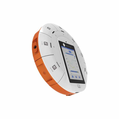


Geography digital laboratory kit
 Privacy Policy
 Delivery policy
 Return policy
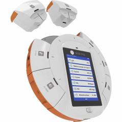
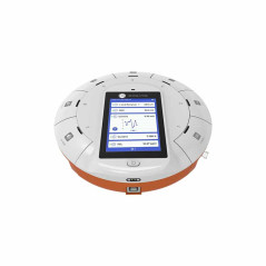
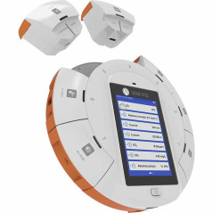
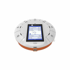
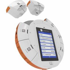
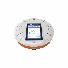
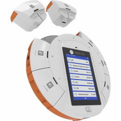
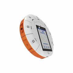
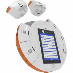
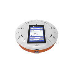
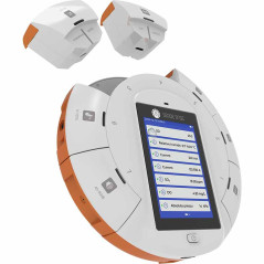
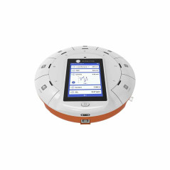
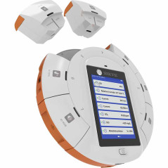
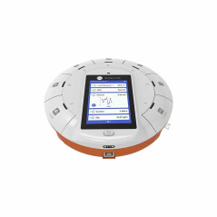
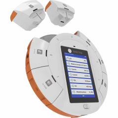
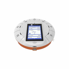
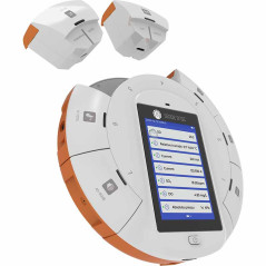
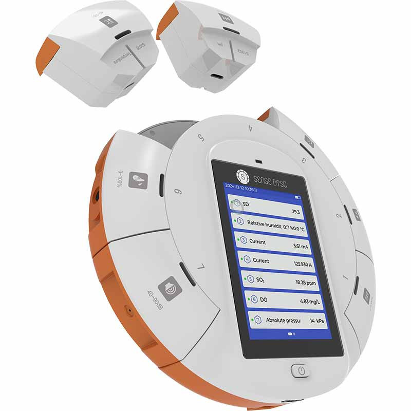
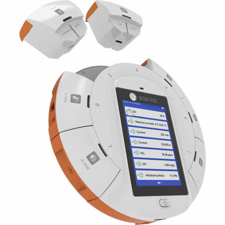
The complete SenseDisc Pro Geography digital lab kit with 18 sensors represents the ideal link between geography textbook theory and direct exploration of the surrounding world.
This GEOGRAPHY digital lab kit based on SenseDisc Pro technology redefines how Earth sciences are taught and understood in modern schools.
Specially designed for studies in Physical Geography, meteorology, pedology, hydrology, and ecology, the kit combines a smart portable console (equipped with 4 built-in sensors: Altimeter, Barometer, Accelerometer, and GPS) with 14 high-precision external sensors and a universal input interface.
Through this GEOGRAPHY digital lab kit, lessons become real scientific expeditions where students collect, analyze, and understand geographical phenomena in real time, directly in the field or in the classroom.
Additionally, for an expanded visual presentation of experiments in the classroom or laboratory, the SenseDisc Pro device connects quickly to an interactive display, PC, or laptop, transforming every demonstration into an impactful interactive lesson.
Main Advantages of the Geography Digital Lab Kit
Development of Scientific Thinking and STEM / STEAM Competencies:
Integrating digital sensors into geography classes enables an interdisciplinary approach to Earth sciences.
Students learn to formulate hypotheses, perform rigorous field measurements, interpret graphs, and draw data-driven conclusions based on real-world evidence.
Applied Field Geography and Digital Mapping (GIS):
Thanks to the GPS module integrated into the SenseDisc Pro console, every measurement performed with this GEOGRAPHY digital lab kit is georeferenced (directly linked to latitude, longitude, and altitude).
Students can create thematic maps of the school, city, or hiking trails, understanding modern spatial analysis and Geographic Information Systems (GIS) through hands-on practice.
Active Learning and Student Motivation:
Working with digital sensors and software applications on tablets or computers significantly increases student engagement.
Being able to see on-screen how atmospheric pressure changes with altitude or how vegetation affects soil moisture turns the lesson into a memorable interactive experience.
Preparation for Green Schools and Environmental Projects:
This GEOGRAPHY digital lab kit is the ideal resource for carrying out activities within "Green School" programs, geography olympiads, and school research projects focused on climate change, environmental protection, and sustainable development.
Complete Multidisciplinary Package: A single GEOGRAPHY digital lab kit covers all branches of physical geography: meteorology, pedology, hydrology, geomorphology, and geophysics.
High Mobility and Portability: The ergonomic format and high-capacity rechargeable Li-Po battery ensure an operating autonomy of over 8 hours, allowing classes to be conducted directly in the field.
Plug & Play Technology with Automatic Logging: The console instantly recognizes connected sensors, eliminating setup downtime and allowing full focus on the lesson.
Automatic GPS Georeferencing: All measurements recorded by this GEOGRAPHY digital lab kit can be overlaid directly onto digital maps using the integrated GPS module.
Seamless Smart Classroom Integration: Connects directly via Bluetooth, Wi-Fi, or USB to laptops, tablets, or interactive displays for interactive data presentation in front of the whole class.
Technical Specifications Geography Digital Lab Kit
1.SenseDisc Pro Base
Total Sensors Available in the GEOGRAPHY kit: 18 sensors (4 integrated into the base + 11 external sensors + 3 sensors for the universal input)
Extension Ports: 1 open universal input port for additional sensors.
Sampling Accuracy: Up to 100,000 samples/second
Screen: 3.5 inch TFT Color Touchscreen (320x240 resolution)
Connectivity: Bluetooth, USB, Wi-Fi
Internal Storage: Integrated flash memory for over 100,000 records
Power Supply: Rechargeable Li-Po battery (operating autonomy > 8 hours)
Analysis Software: iLab (included, with user license)
OS Compatibility: Windows, macOS, iOS, Android, Linux
2.iLab Data Analysis Software Specifications
Display Modes: Line graph, analog gauge, digital display, data table, GPS map
Analysis Functions: Curve fitting (linear, polynomial, exponential), derivation, integration, statistics
Real-Time Processing: Live sampling and graphical rendering of data from all connected sensors
Data Export: CSV, Excel format, graph image, laboratory project saving
Experiment Settings: Adjustable sampling rate, recording duration, and triggers
3.Integrated Sensors in the SenseDisc Pro Base (4 Sensors)
Altimeter: Resolution 0.1 m
Applications: Altitude measurement in field experiments and relief analysis.
Barometer: Range 30-120 kPa, Accuracy 0.1 kPa (relative accuracy 0.006 kPa)
Applications: Monitoring atmospheric pressure and weather stages.
Triaxial Accelerometer: Range -8g to +8g | Resolution 0.016g | Accuracy ±2.5%
Applications: Study of 3D motion, vibrations, and gravity.
GPS Sensor: Position accuracy 2.5m CEP50, Speed accuracy 0.1m/s, Max update rate 10Hz
Applications: Geolocation of data collection points in environmental experiments.
4.External Sensor Package (11 Sensors + 3 Sensors for Universal Input)
1.Temperature Sensor:
Measuring range: -40°C to 135°C
Accuracy: ±0.6°C
Resolution: 0.1°C
Experiments on heat absorption and dissipation, study of boiling and freezing points, thermodynamic chemical reactions, and Joule's law
2.Surface Temperature Sensor:
Usage: Measuring the surface temperature of objects, gases, as well as non-corrosive acidic and alkaline liquids.
Measuring range: -30℃ ~ 150℃
Accuracy: ±0.8°C
Resolution: 0.1°C
Typical experiment: Thermal conductivity comparison of different substances.
3.Light Sensor:
Usage: Measuring the light intensity of the tested environment.
Measuring range: 0~55000 Lux
Accuracy: ±5%
Resolution: 15 Lux
Used for sensitive, accurate, and rapid measurement of ambient light intensity. Typical experiments: Exploring the relationship between illuminance and distance (inverse-square law in optics) and studying photosynthesis.
4.Magnetic Field Sensor:
Usage: Measuring magnetic field intensity.
Measuring range: -64mT~64mT
Accuracy: ±3%
Resolution: 0.04mT
Usage: Study of uniform magnetic fields, verifying the direction of circular current magnetic fields, and other experiments.
5.Geiger-Müller Radiation Sensor (Radiation Monitor):
Usage: The G-M S0022 sensor is used for studying radioactivity experiments.
Mainly used to measure the intensity of gamma (γ) and beta (β) rays.
Measuring range: 0 ~ 40000 c/min
Accuracy: ±2% F.S.
Resolution: 1 c/min
6.Absolute Pressure Sensor:
Usage: Measuring gas pressure in an atmospheric environment or enclosed space.
Measuring range: 0~400 kPa
Accuracy: ±2%
Resolution: 0.1 kPa
Used for measuring absolute gas pressure in atmospheric environments or enclosed spaces.
Typical experiments: Atmospheric pressure measurement, chemical reactions of metals with hydrochloric acid and diluted sulfuric acid.
Experiments with compression ignition devices, water boiling studies, and pressure-temperature relationships.
7.Salinity Sensor:
Usage: The salinity sensor consists of a black platinum conduction electrode and corresponding conditioning circuitry.
Calculates salinity concentration by measuring conductivity concentration in a macroion solution.
Increasing ion concentration in the solution increases conductivity.
Current is directly proportional to conductivity.
Measuring range: 0~55000 ppm
Accuracy: ±2.5% F.S.
Resolution: 16 ppm
8.Soil Temperature and Humidity Sensor:
Usage: The soil temperature and moisture sensor is connected to a computer for data collection, displaying, and recording real-time soil temperature and moisture changes, and generating soil temperature and moisture graphs over time.
Measuring range: 0-100%, -40 to 80°C
Resolution: 0.1%, 0.1°C
Accuracy: ±2% in the 0-50% range, ±3% in the 50-100% range, ±0.5°C
Probe protection rating: IP68
Probe length: 70mm ±6mm
Probe material: Special corrosion-resistant electrode
Probe sealing material: Flame-retardant black epoxy resin
Usage: Experiments studying heat absorption and dissipation for objects of different colors, experiments on the influence of abiotic factors on woodlice (oniscidea) distribution.
Heat absorption and dissipation for different liquids, water cooling models, mechanical work through friction, water boiling experiments, boiling point vs. pressure relationship, Joule's law, acid-base reaction heat, iron corrosion in the presence of oxygen, etc.
9.Ultraviolet (UV) Radiation Sensor:
Usage: The UV sensor is used to detect ultraviolet light.
The wavelength of UV light in the electromagnetic spectrum ranges from 100nm to 400nm.
The sensor converts UV light into a voltage signal directly proportional to UV light intensity.
Measuring range: 0~400 W/m²
Accuracy: ±5%
Resolution: 0.1 W/m²
Typical experiment: Testing local UV radiation intensity and the effects of varying UV intensity on biological survival rates.
10.Frequency Sensor:
Usage: Frequency sensors are used to measure the frequency of alternating current (waveform).
Adaptable to a wide range of scenarios.
The AC voltage signal is converted into a standard TTL square wave via a high-resistance internal buffer and a high-speed gate circuit, counted by an internal timer/counter to convert frequency.
Measuring range: 1Hz~8MHz
Accuracy: ±1%
Resolution: 1Hz
Typical experiment: Measuring alternating current frequency.
11.Ambient Temperature Sensor:
Usage: The ambient temperature sensor is used to measure ambient temperature in the tested environment.
Measuring range: -40℃~85℃
Accuracy: ±0.5℃
Resolution: 0.1℃
Sampling rate: Maximum 10 times/second
Typical experiment: Measurement of environmental temperature changes, Monitoring weather conditions, Monitoring greenhouse conditions, etc.
Open Universal Input
Allows connection of any additional external sensor from the product range.
The 3 universal sensors that can be connected separately to the open universal input:
1.Relative Pressure Sensor:
Usage: To measure the pressure difference between gas in the atmospheric environment and the measured space.
Measuring range: -20kPa ~ 20kPa
Accuracy: ±5%
Resolution: 0.01kPa
Typical experiments: Fluid pressure vs. flow rate relationship, etc.
2.Relative Humidity Sensor:
Usage: Measuring relative humidity in the air.
Measuring range: 0~100%
Accuracy: ±4% (10%~90% RH)
Resolution: 0.1%
Used for: Exploring inhaled and exhaled human breath, measuring living environment humidity, exploring candle combustion.
Water absorption by concentrated sulfuric acid, air quality detection, plant transpiration, abiotic factors influencing rat distribution, proving air contains water vapor, environmental humidity measurement, etc.
3.Dew Point Sensor:
Usage: Used to measure dew point.
Measuring range: -40~60℃
Accuracy: ±3℃
Resolution: 0.01℃
Sampling rate: Maximum 10 times/second
Used for: Measuring dew point changes in the environment, monitoring weather conditions, monitoring greenhouse conditions, etc.
Usage Scenarios for Geography Digital Lab Kit
1.Practical Meteorology and Mobile Weather Station:
Educational objective: Understanding atmospheric dynamics, weather formation, and acquiring weather forecasting skills.
Execution: Students build a mobile school weather station directly in the schoolyard or during outdoor hikes.
Using this Geography Digital Lab Kit, they record barometric pressure, ambient temperature, dew point, and UV radiation levels in real time.
Data is compared across different hours of the day or seasons to analyze air mass evolution and conditions for condensation and precipitation formation.
2.Pedology and Soil Cover Study:
Educational objective: Analyzing the physical and thermal properties of different soil types and their importance for vegetation.
Execution: During field applications, a Geography Digital Lab Kit is used to measure and compare moisture and temperature at various depths in sandy, clay, chernozem, or forested vs. eroded soil areas.
Data is directly correlated with slope inclination and vegetation coverage.
3.Hydrology and Water Resource Analysis:
Educational objective: Assessing continental water quality, mineralization, and human impact on hydrological resources.
Execution: Students collect and analyze water samples from rivers, lakes, springs, or ponds near the school using the salinity sensor included in this Geography Digital Lab Kit.
Dissolved salt levels and water quality are thus determined. Thanks to the integrated GPS module, each sampling point is automatically georeferenced on the digital map of the area.
4.Geomorphology and Topographic & Climatic Profiling:
Educational objective: Understanding the influence of terrain and altitude on climatic parameters (vertical lapse rate and pressure gradient).
Execution: During a field trip or hike (traversing a hill or mountain trail), this Geography Digital Lab Kit continuously records altitude, pressure, and temperature.
By connecting to the iLab app on a laptop, tablet, or interactive display, students automatically generate topographic and microclimatic profiles of the route.
5.Geophysics, Rocks, and Ambient Environmental Radioactivity:
Educational objective: Identifying physical properties of the Earth's environment, magnetic anomalies, and background radiation.
Execution: Students investigate natural ionizing background radiation using the included Geiger-Müller sensor, comparing granitic, limestone, or dense urban areas.
Additionally, using the magnetic field sensor, local magnetic anomalies caused by specific rock formations or metallic structures can be identified and analyzed.
Package Contents Geography Digital Lab Kit
SenseDisc Pro Datalogger Console (with 4 integrated sensors: Altimeter, Barometer, Triaxial Accelerometer, GPS)
USB data and charging cable
Power adapter
1.Temperature Sensor
2.Surface Temperature Sensor
3.Light Sensor
4.Magnetic Field Sensor
5.Geiger-Müller Radiation Sensor (Radiation Monitor)
6.Absolute Pressure Sensor
7.Salinity Sensor
8.Soil Temperature and Humidity Sensor
9.Ultraviolet (UV) Radiation Sensor
10.Frequency Sensor
11.Ambient Temperature Sensor
12.Relative Pressure Sensor
13.Relative Humidity Sensor
14.Dew Point Sensor
iLab data acquisition and analysis software suite (compatible with Windows, macOS, iOS, Android, Linux, HarmonyOS)
User manual and quick experiment guide for teachers and students
Specific References
No customer reviews for the moment.
Geography digital laboratory kit